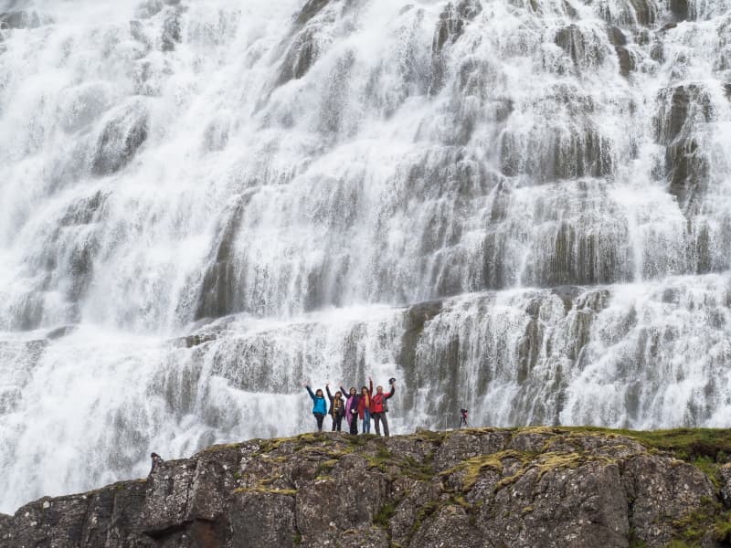
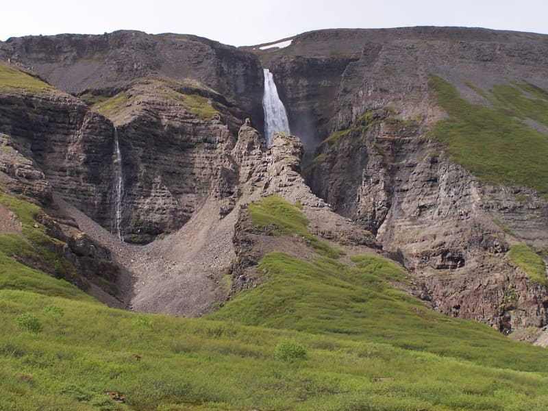
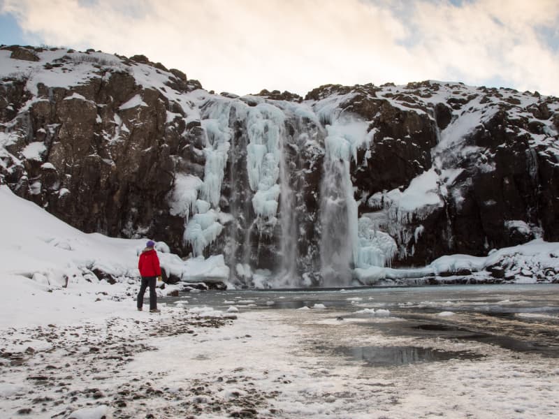
Dynjandi
Simply enthralling; The Westfjords’ favourite front-page model for decades, and is never short of breathtaking. The biggest and widest part of the waterfall is the one that gets all the attention and the photos, even though there are impressive, albeit smaller, waterfalls further down the river. The waterfall and its surroundings were protected as a natural monument in 1981, as it is a unique natural gem.
Dynjandi cascades down approximately 100 meters. The waterfall steps are formed due to the stratification of the rock into lava layers and looser intermediate layers. The lava layers create the steps, while the river has carved out the intermediate layers. There are six waterfalls in Dynjandi. At the top is Fjallfoss, followed by Hundafoss, Strokkur, Göngumannafoss, Hrísvaðsfoss, and Sjóarfoss.
To appreciate the scenery, park your car in the designated lot and walk for 15 minutes to reach the largest part of the waterfall. Take in the stunning view and the refreshing air.
View
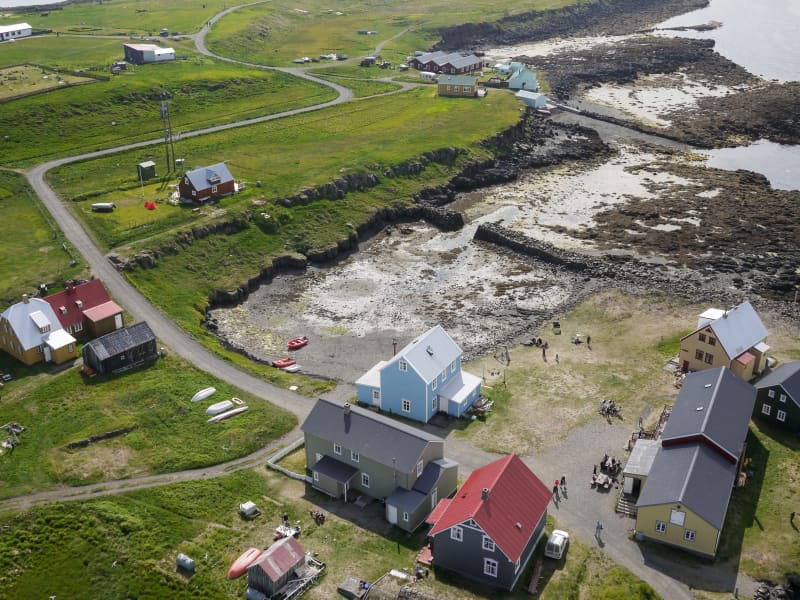
Flatey Island
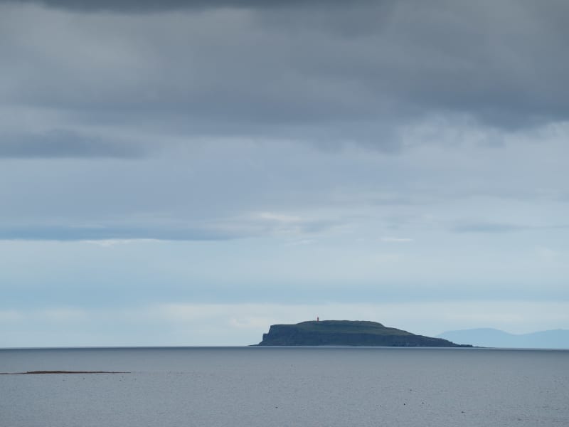
Breiðafjörður is the second biggest fjord in Iceland as it stretches 70 km where it is widest. Where the fjord gets more shallow there are almost uncountable number of islands but if we would have to guess a number, they would be around 2800. Many of those islands were inhabited few decades ago but now almost all are uninhabited.
Flatey is the one exception. Flatey is the biggest of the islands in Breiðafjörður. It also is the only island in Breiðafjörður where inhabitants live the whole year round. The inhabitants count as many as 6 persons but during summertime the population multiplies. Many of the other islands in Breiðafjörður used to be inhabited not so long ago like Hvallátur, Svefneyjar and Akureyjar. All the islands have one thing in common. They are all made by the force of glaciers in the ice age. The islands are mostly flat and the geological layers are similar to the ones on the Westfjords. In most of the islands there are many plants and the birdlife is diverse with puffin, eider and black guillemot being the kings of the fjord along with the White-tailed-Eagle. The history tells us that the people that lived in Breiðafjörður never had to deal with shortage of food because of the plentyful gifts of nature such as birds, fish and shells. When there were bad conditions and food shortage was common in Iceland, people fled to Breiðafjörður bay where there was plenty of food for everyone.
View
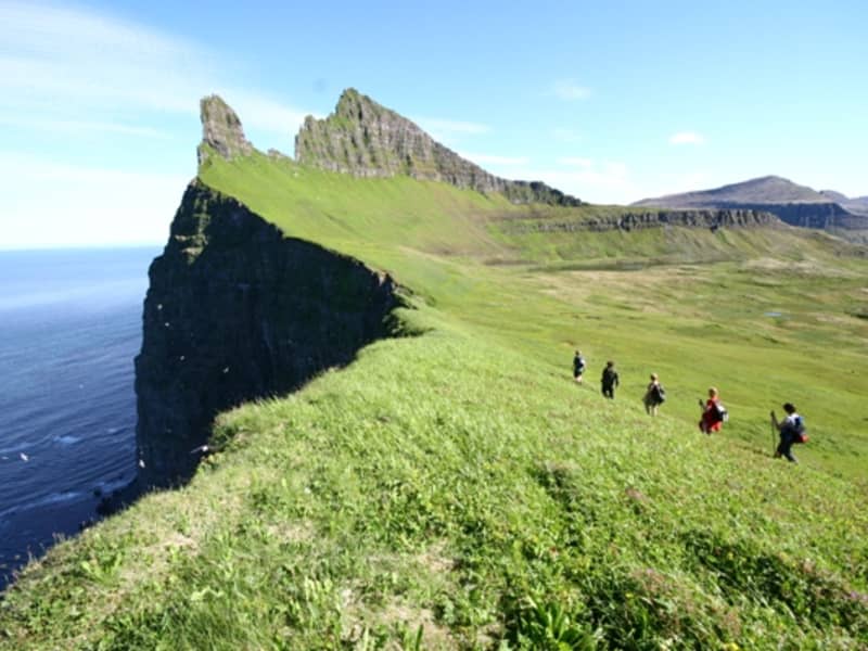
Hornstrandir
This territory of the Arctic fox has been uninhabited since the 1950s. As isolated as it was then, it attracts the casual half-day visitors and serious gore-tex hikers alike. Its main attractions are three. First, the bird cliffs surrounding the bay of Hornvík, are a magnet of gigantic proportions. On the eastern side of the bay the cliff reaches a height of more than 500 metres, and the birds are teeming. Second, as there are no infrastructure and the tourists few in relation to the sheer size of the area, the sense of remoteness is strong. You can hike days on end without seeing a single person. Additionally the phone connection is very poor, often there is no connection at all. The nature is pure and the tranquillity unmatched. Third, as the area is a haven for the Arctic fox (think hunting-ban and bird-packed cliffs), the chances of spotting one are high.
Most tours, especially day tours, depart from Ísafjörður. Hikers wanting to go on their own can also take boats from Bolungarvík and Norðurfjörður.
For further information on the Hornstrandir Nature Reserve, please visit https://ust.is/english/visiting-iceland/protected-areas/westfjords/hornstrandir/ . The Hornstrandir Visitor Centre is located in downtown Ísafjörður.
View
Látrabjarg
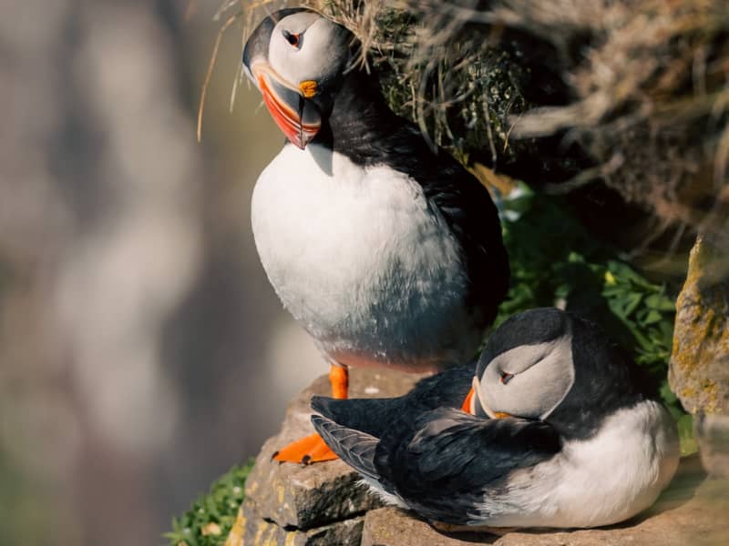
One of Europes biggest bird cliffs, a home to birds in unfathomable numbers. This westernmost point of Iceland is really a line of several cliffs, 14 kilometres long and up to 441 m high. And it’s as steep as it gets, dizzyingly so. Safe from foxes, the birds are fearless, and provide stunning photographic opportunities from close range. The puffins are the ones frequenting the grassy, higher part of the cliffs.
But look out, the edges are fragile and loose and the fall is high. Látrabjarg is thus deservedly the most visited tourist attraction in the Westfjords. The cliffs are easily accessible by car and when you’re there, a walk along the cliffs awaits. The whirling sensation will not fade, and neither will the memories.
View
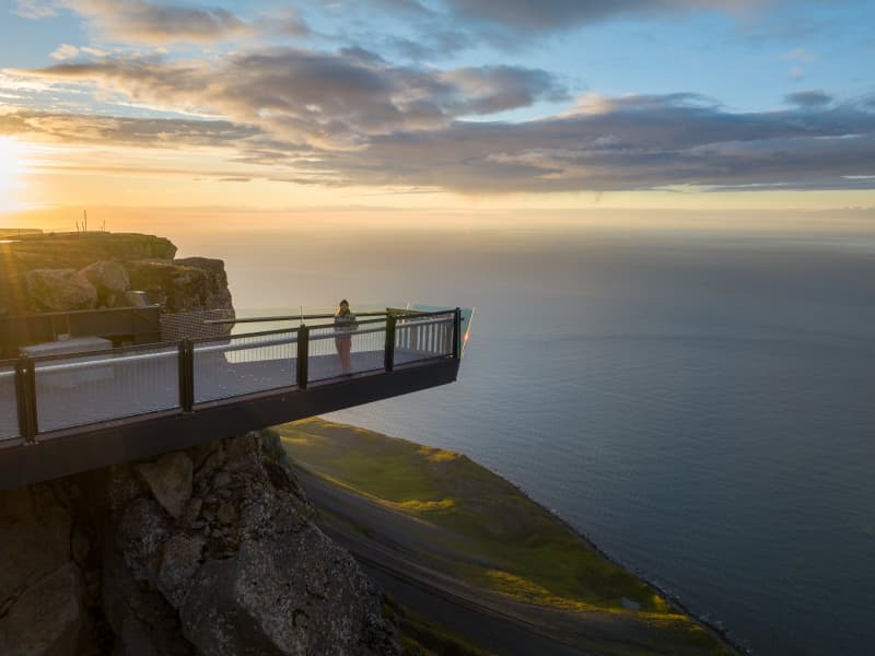
Outstanding Bolafjall
The most popular visiting point in Bolungarvík is the viewing platform on top of Bolafjall Mountain. The place offers a staggering view over Ísafjarðardjúp, Jökulfirðir and some people say all the way to Greenland. To get to Outstanding Bolafjall you have to drive up the road from Bolungarvík up to the radat sation situated at the summit of Bolafjall. The station was built by the Americans but is now controlled by the Icelandic coast guard. Following a visit to Bolafjall, or perhaps even before ascending, we highly recommend taking a coffee break and enjoying a leisurely stroll along the black sand beach in Skálavík.
Please note that access to the mountain road is contingent upon favorable conditions. Typically, the road is open from mid-June until mid-September.
View
Grímsey
Situated just off shore from Drangsnes in Steingrímsfjörður, the island of Grímsey is a true gem of nature. From Drangsnes there are scheduled boat trips to the island, which take around 10 minutes. In Grímsey there is abundant birdlife and beautiful nature. We recommend at least 2 hours stay on the island to explore the island and it's birds. For more information about the boat trips, contact Malarhorn cafe.
View
Valagil
Valagil is a spectacular ravine, complete with mighty waterfall and made from layers upon layers of ancient lava. You will find Valagil at the landward end of Álftafjörður, not too far from Súðavík. There is a marked footpath to the ravine from the road. Some say the ravine is named after the falcons (valur is Icelandic for falcon) which reported used to nest there. Other people say it is named after a woman called Vala who is said to have fallen to her death in the gully centuries ago.
View
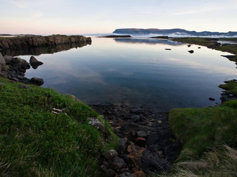
Vatnsfjordur
Vatnsfjörður nature reserve is an area of total 20.000 ha. 80% of the area is rocky and barren but the lowlands is mostly covered with birchwood. From Vatnsfjörður it's perfect to visit most of the Westfjords. It takes you about one and a half hour to drive either to Látrabjarg, to Selárdalur or even to Ísafjörður. It takes you half an hour to drive to Dynjandi and it's a one hour sail from Brjánslækur to Flatey island.
View
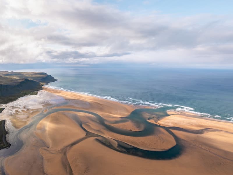
Rauðasandur
Rauðasandur (Red Sand) is precisely that: a beach with endless red sand. Well, not endless but 10 km is a lot.The striking tones of the sand shift with the light and weather, making each visit a unique experience. The beach is the biggest pearl in a string of coves with sand ranging in colours from white through yellow through red to black, and in coarseness from very fine to sharp seashells. It's a haven for seabirds and seals, offering unparalleled tranquility. You might want to step out of the car, get the camera out and start walking on the seemingly endless beach.
Admire the stunning view, with the majestic Snæfellsjökull glacier on the Sæfellsnes peninsula captivating your gaze in the distance.
View
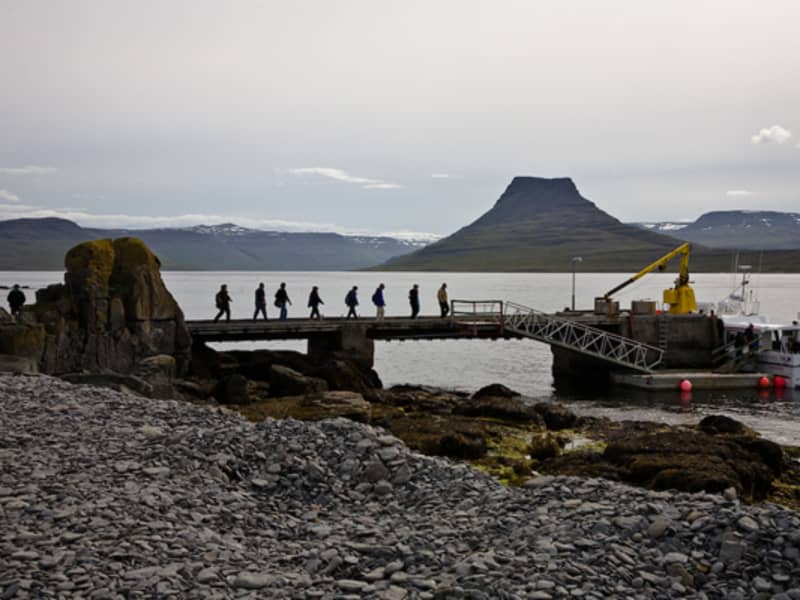
Vigur
Vigur is one of three islands in Ísafjarðardjúp, named for its spear-like shape. The island's distinctive wildlife makes it a favorite among travelers.
Puffins, eiders, guillemots, and arctic terns abound on Vigur, drawing many visitors. Puffins, often called the penguins of the north, nest in burrows that cover much of the island. To avoid collapsing these burrows, travelers must stick to designated paths. Despite being clumsy fliers, puffins impress visitors by expertly stacking their beaks with sand eels or small fish to feed their chicks.
In contrast, arctic terns are fiercely protective and will aggressively defend their territory from intruders, though holding a stick above one's head usually keeps them at bay. Eiders and humans coexist harmoniously on the island; eiders nest near human dwellings, gaining protection, while people collect the valuable eiderdown from their nests.
In Vigur you find the smallest post office in Iceland, as well as the only windmill and beautifully renewed houses.
To get to Vigur, there is a daily boat tour from Ísafjörður.
View
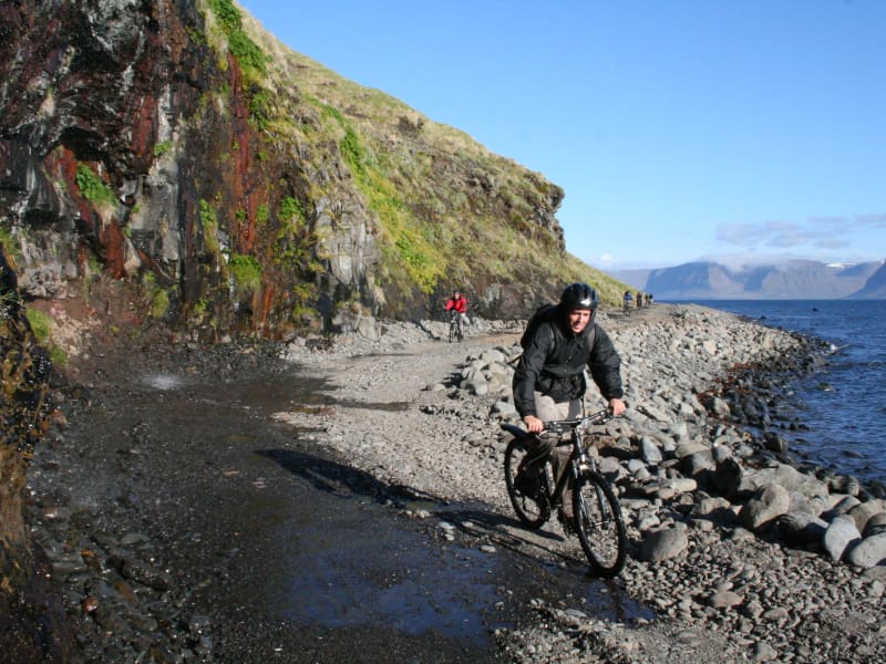
Svalvogar
Svalvogar is a 49-kilometre circular route between the fjords of Dýrafjörður and Arnarfjörður. It usually starts and finishes in Þingeyri and takes the narrow exposed coastal track around the headland (not to be attempted at high tide) and comes back along the Kaldbakur route, past the Westfjords’ tallest mountain in the so-called Westfjords Alps. Sometimes called the Dream Road, Svalvogar is among the most beautiful routes in the country. It is not suitable for small cars and is best enjoyed by mountain bike. Be prepared for a workout, or consider taking a 4x4 vehicle.
If passengers are afraid of heights, it's recommended to begin the route from Arnarfjörður and drive towards Dýrafjörður. This way, when passing another car, yours will be on the right side of the road, which is less intimidating than driving alongside the sea.
View
Foss í Fossfirði
Fossfjörður is one of the the offshoot fjords of Arnarfjörður. It is the westernmost of the so called "Suðurfirðir", the Southern Fjords. In Fossfjörður, there is a farm named Foss and a waterfall with the same name—Foss, which means "waterfall." So, in Waterfall Fjord, you'll find a farm called "Waterfall" as well as a waterfall named "Waterfall." Confusing?
Maybe a little. In Fossfjörður you will also stumble up on the so called A-house, wich has been a popular pitstop among travellers and photographers. This abandoned house is unique for its shape and location.
View