Skip to content

Or try searching by Category and/or Location

Vestfjarðaleiðin – the Westfjords Way is a touring route of approximately 950 km around the Westfjords of Iceland. The route connects the region's towns and villages with dramatic fjords, mountain passes, beaches, waterfalls, hot pools, cultural sites and some of the best-known natural attractions in the Westfjords.

The route was developed by Visit Westfjords and Visit West Iceland to make it easier for visitors to explore the region as a road trip. Rather than following a fixed itinerary, travellers can choose where to stop, how long to stay and which experiences to include along the way.

Vestfjarðaleiðin is pronounced approximately “Vest-fyar-tha-lay-thin” and translates as “The Westfjords Way”.

Driving is an important part of the experience. The route follows long fjords, crosses mountain passes and passes through tunnels, with sections of gravel road still found in parts of the region. Distances can take longer to drive than they appear on a map, so visitors should allow plenty of time and check current road and weather conditions before setting out.

Along the way are small fishing villages and rural communities where visitors can find locally run hotels, guesthouses, restaurants, cafés and museums. Seafood is central to the food culture of the Westfjords, while local lamb, baked goods and other regional food experiences can also be found around the route.

Nature is never far away. The Westfjords Way passes waterfalls, beaches, mountains, geothermal pools and long stretches of coastline. Wildlife may include seals, whales, Arctic foxes, puffins and other seabirds, depending on location and season.

The route also provides access to many of the Westfjords' best-known places, including Dynjandi, Látrabjarg, Rauðasandur and communities throughout the region. Travelling the full route gives visitors the opportunity to experience both the landscape and the history, culture and everyday life of the Westfjords.

The Westfjords Way can be explored as a complete road trip or in shorter sections. Conditions and accessibility vary by season, particularly during winter, so travel plans should always take current road and weather information into account.
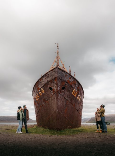
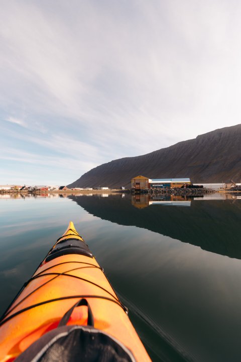
Discover Vestfjarðaleiðin

For people who are keen to discover new places and get off the beaten track, the route can be followed independently through self-drive or in small groups. This is about slow tourism based on sustainable experiences sharing the way of life of people who have lived here for generations. Vestfjarðaleiðin offers different kind of experience to help visitors explore the route:

Instagrammable icons
Read more
Taste the place
Read more
Stories
Read more
Getting wet
Read more
Taking the air
Read more
Drive Highlights
Read more

FAQ category

Where can I check road conditions for the Westfjords Way?

Always check current road conditions before setting out, especially during winter or periods of poor weather. The official Icelandic road information service provides up-to-date information about road conditions and closures.

Check current road conditions at umferdin.is.

How long does it take to drive between places in the Westfjords?

Driving times can be longer than distances on a map suggest because roads follow long fjords and cross mountain passes. Allow extra time for changing road conditions, scenic stops and slower sections of road.

Can I drive the Westfjords Way in winter?

Yes. The main roads around the Westfjords are serviced during winter and are regularly used by local traffic. As with winter driving elsewhere in Iceland, visitors should be prepared for snow, ice, strong winds and rapidly changing conditions.

Drive according to the conditions, allow extra time, and check the latest road conditions and weather forecast before travelling. Drivers who are not comfortable with winter conditions should consider their travel plans carefully.

Are there fuel and charging stations along the Westfjords Way?

Yes. Fuel stations are available in towns and villages along the route, and electric vehicle charging stations can be found in most larger communities as well as at several locations along the route itself.

Distances between services can be greater than visitors may be used to, so it is sensible to refuel or recharge regularly and check the location and availability of services in advance, particularly outside the main summer season.

Should I drive the Westfjords Way clockwise or counter-clockwise?

Both directions work well. The Westfjords Way is a circular touring route, so the best direction depends on your starting point, accommodation plans, weather and the attractions you want to visit. There is no required direction of travel.

Do I need a 4x4 to drive the Westfjords Way?

No. A 4x4 is not normally necessary for driving the main Westfjords Way, either in summer or winter. The main roads are suitable for ordinary cars when conditions are good. However, visitors should choose a vehicle they feel comfortable driving and take current road and weather conditions into account, particularly during winter.

Some side roads and more remote routes may have different requirements, so always check road conditions before taking a detour.

Is the Westfjords Way fully paved?

No. Most of the main route is paved, but some sections and roads leading to individual attractions may still be gravel. Drive according to conditions and slow down when moving between paved and gravel surfaces.

Do I have to drive the entire Westfjords Way?

No. The Westfjords Way can be travelled as a complete road trip or explored in shorter sections. Visitors can choose an itinerary based on the time available, the season and the places they most want to visit.

How many days do I need for the Westfjords Way?

Allow at least four to five days if you want to travel the full route without rushing. A longer trip gives you more time for hiking, wildlife watching, museums, hot pools and detours to attractions along the way.

How long is the Westfjords Way?

The Westfjords Way, or Vestfjarðaleiðin, is a touring route of approximately 950 km around the Westfjords and Dalir. The route connects towns, villages, natural attractions and scenic areas throughout the region.